Diapontia Islands
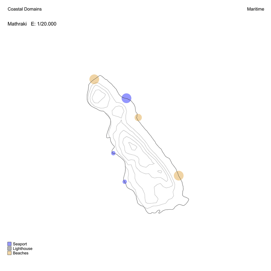
Maritime Networks
José Aguilar Martínez


© Francesco Resta @ MarineTraffic.com
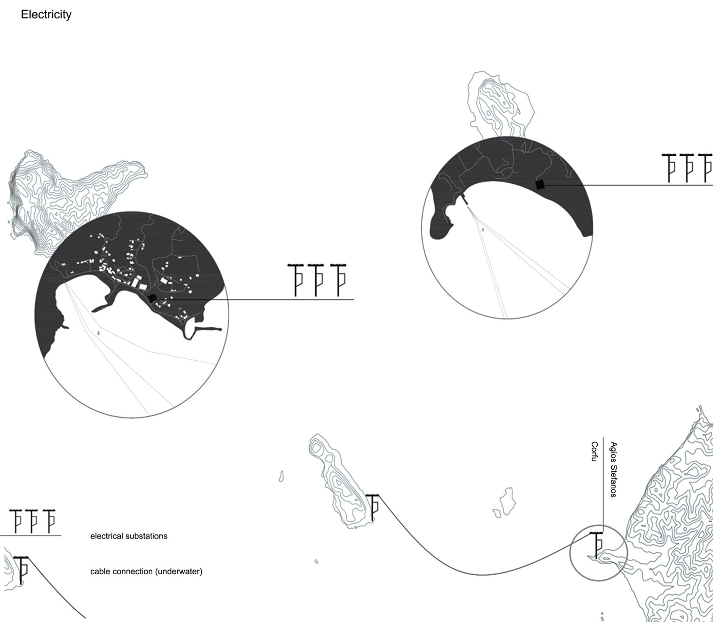
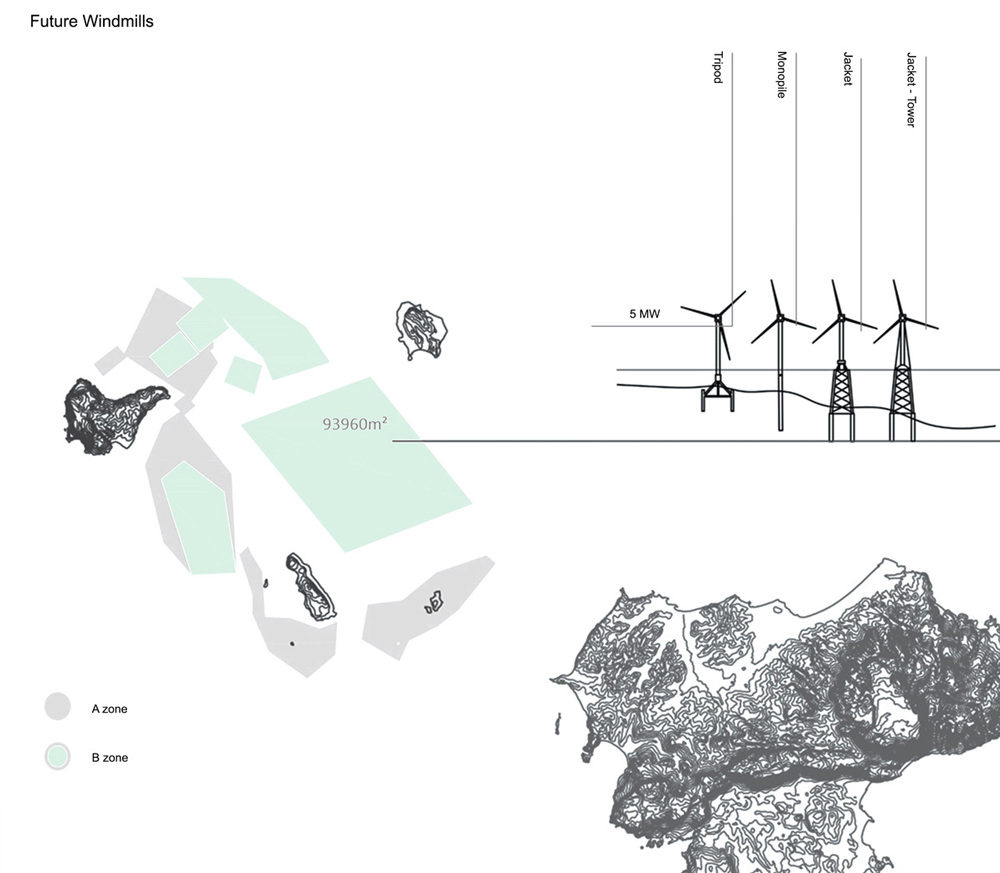
Energy & Resources
Marilina Fanou


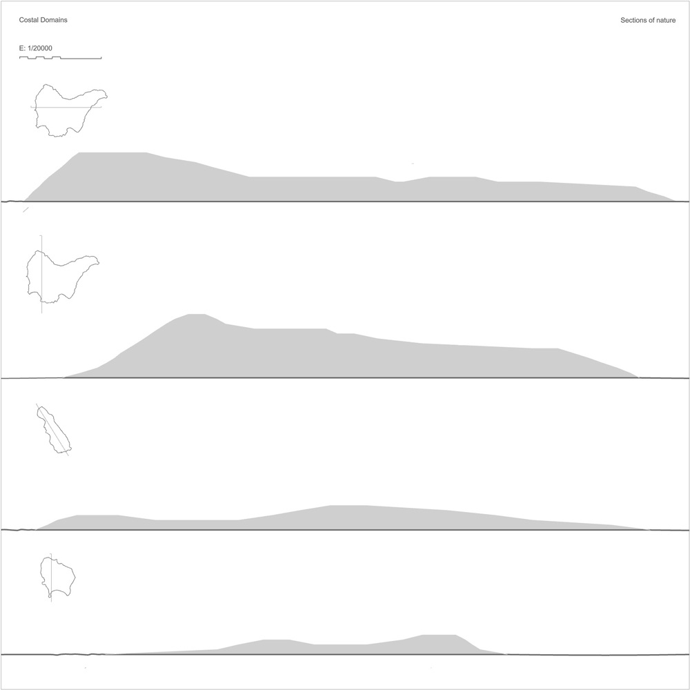
Nature & Food
Tamara Arroniz Marín
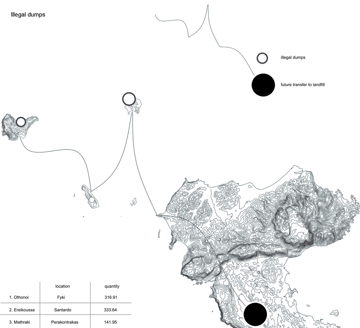
The research focuses on the nature and production of Diapontian archipelago. It analyzes the the flora and fauna of the islands as well as the crops observed there. It records the important natural areas, along with the most significant animals, both aquatic and terrestrial, which predominade that area.


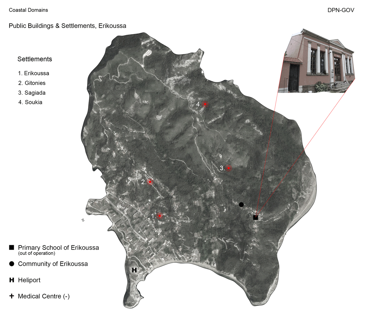
Governance
Natalia Papageorgiou
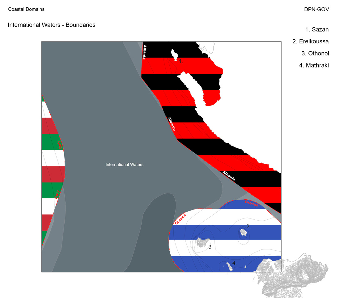
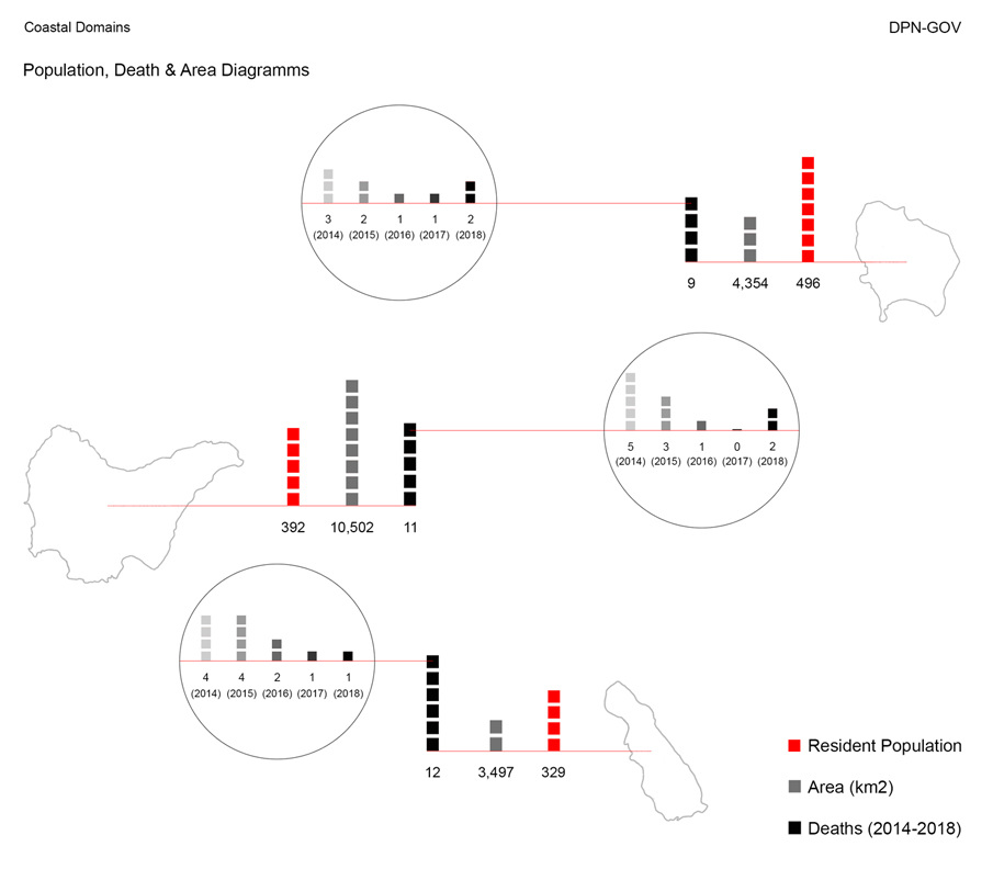
This research deals with the part of governance of Diapontian Islands. More specifically, it analyzes the boundaries between Greece, Italy, and Albania, the local government of each island, the idiomatic expressions of the local dialect and the official origin of its island’s name. It, also, locates the settlements and the public services, such as schools, medical centers, community buildings and heliports. Last but not least, it compares the population, the deaths and the area of all three bigger islands of the Diapontian Archipelago.

old maps: corfu museum, philographikon, antiqua print gallery, historic cities, romeartlover.tripod, italiaingrecia.blogspot, wikimedia commons, discusmedia
Tourism
Stefania Voulgari
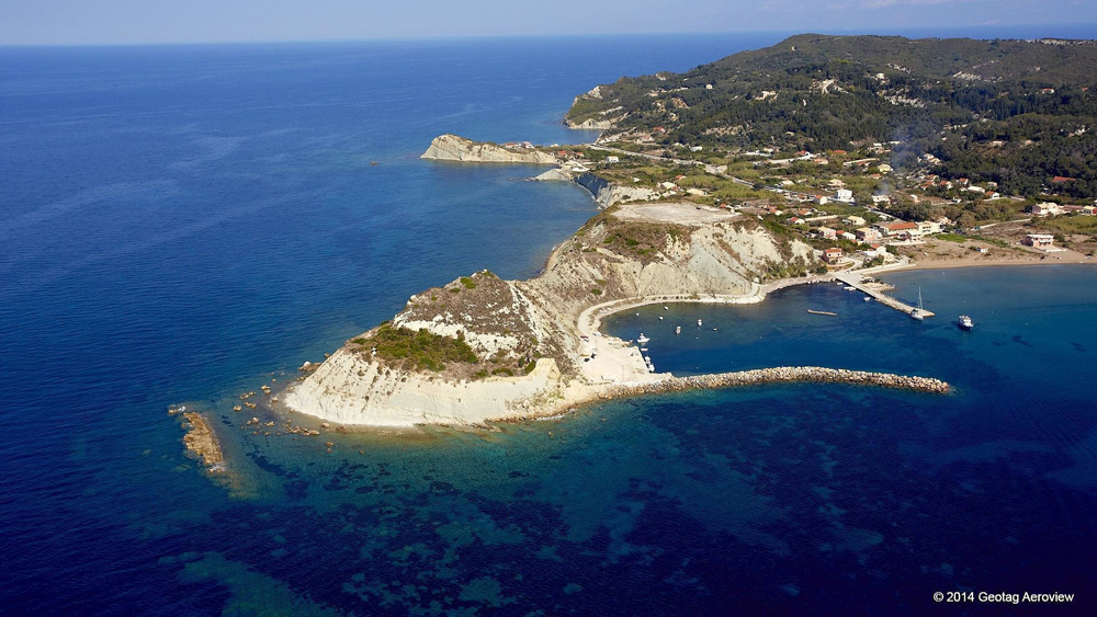
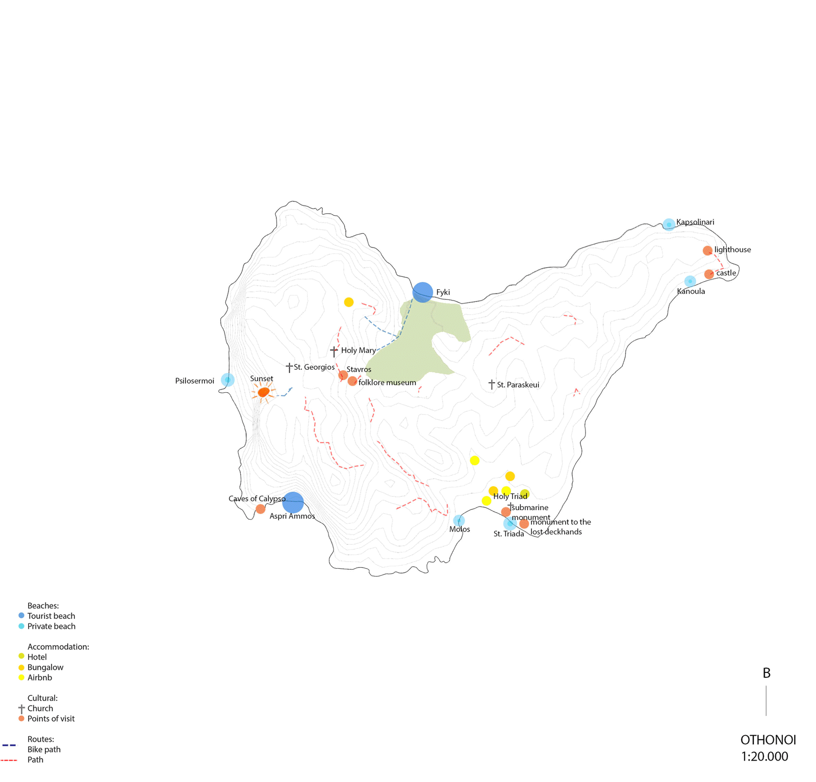
The Diapontian Islands is an island complex of eleven islands, consisting of the three largest islands and a few other islands north-northwest of Corfu consisting of the island of Othonoi, the largest of the Diapontian Islands and the westernmost point of the Greek territory, Ereikoussa and Mathraki and the uninhabited islands: Diakopo, Diaplo, Karavi, Kastrino, Lipso, Ostrako, Plaka, Plateia and Tracheia.
According to mythology, in ancient times, the Othonoi was the island of the nymph Calypso, who lived in a large cave. Odysseus fell in love with her and remained there for seven years. Odysseus left the island with a raft and sank to Scheria, on the island of Corfu.
The research is based on the part of tourism on these islands. These islands are not characterized by high tourism, as most of the population of both Greece and the rest of the world ignore its existence. They are characterized by the tranquility that prevails in them and the walks between them. However, those who know them and want to spend a quiet holiday choose to visit them mainly in the summer.
However, according to anti-regional tourism of Ionian Islands, Spyros Galiatsato, the elements of the tourist movement of these islands are confusing as there are transport problems. Access to the islands is achieved by boat on specific days of the week. There are also private ports accessible to islanders. The islands also have emergency helicopters.
There are three types of touristic accommodation: hotel, apartment or Airbnb. It is observed that the accommodation in each island is small in number. The touristic activities include swimming, cycling, hiking, diving, fishing and sightseeing on the island.

old map: Bory de Saint-Vincent, Jean Baptiste, Map of the northwestern coast of Corfu, with Othonoi, Ereikoussa and Mathraki islets, 1823
@ travelogues
@ travelogues

Inhabitation
Zografia Zaraveli
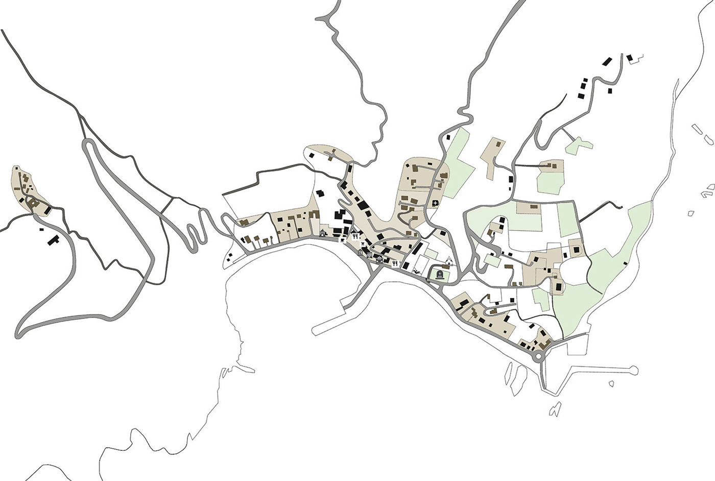
My research is based on a record of the density of buildings, settlements, accommodation and the natural and structured environment in the three islands (Ohonoi, Ereikoussa, Mathraki). More specifically, the analysis focuses on the central settlements of the islands, the relationship between the buildings and the runways, and in general the environment around them, because the connection they establish with each other is quite important.
Difficult living conditions, especially during the winter time, have greatly reduced the number of permanent islanders. It is estimated that permanent residents in all three islands do not exceed 200, many of whom are Albanian immigrants. A visit to the Diapontian Islands is of great tourist interest, especially for those seeking rest for their holidays.
The Othonoi is the westernmost point of Greece and the largest of the Diapontian Islands. It is a former community of the Ionian Islands. It is part of the Municipality of Corfu with a population of 392 (2011). The Othons are divided into two regions: the Upper Panda and the Lower Panda. There are more than 20 settlements. In the 19th century the island was the capital of the Municipality of Diapontia, which also included the nearby islands of Ereikoussa of Mathraki. The Othonians are about 47 nautical miles from the cape Santa Maria di Leuca, Italy.
Ereikoussa is part of the Municipality of Corfu. It is the most densely populated island of the Diaspora. It is located in the northwest of Corfu island. Its population was 496 at the 2011 census and its area covers 3.65 square kilometers. The island is rich in green forests and olive trees. Two beaches are formed in the island, Porto and Bragini, whose names date back to the Venetian rule.
Mathraki is part of the Municipality of Corfu. It covers an area of 3,532 square kilometers and a population of 329 (2011). It is 45 minutes away from the coast of Corfu. It has three restaurants, villas and "rooms to let". The municipal unit comprises the three nearby islands of Diakopo, Diplo and Trachia.